One of the first large-scale apartment complexes in Korea was the Mapo apartment complex, built between 1962 and 1964 in Dohwa-dong in Mapo-gu. As Andrei Lankov says in this article, "it was the Mapo complex that truly started the history of large-sale apartment construction in Korea." He goes on to describe all of the difficulties the developers faced when they were designing, building, and ultimately, trying to sell it (Antti notes also that the Korean Housing Corporation used marmots to test rooms for gas leaks). One other fact he mentions leads me to ask this question: Does anyone else find irony in the fact that it was built on the location of a former prison? Jokes about apartment complexes and prisons aside, the prison in question was Mapo prison. According to this page, in October 1908, Gyeongseong (the Japanese name for colonial Seoul) Jail (Gamok) was built near Seodaemun by the Japanese, but when a new prison was built near Mapo, it was named Gyeongseong Gamok instead, and the former prison's name was changed to Seodaemun Gamok in September, 1912. This page reveals that
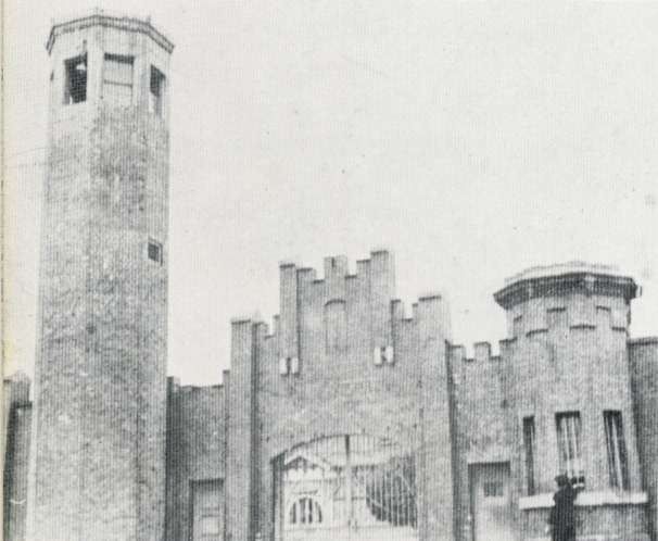 Mapo prison during the colonial era.
 Mapo prison on a 1946 US military map of Seoul
("Prison brick yard")
 The plan for the Mapo Apartments, 1962.
In the photo below is the complex as it looked in 1963. Notice the absence of the long, rectangular apartment buildings which surround the complex in the plans above - they were obviously built later.

Here's what the finished complex, made up of ten, five-storey buildings, looked like from the air (looking northeast):
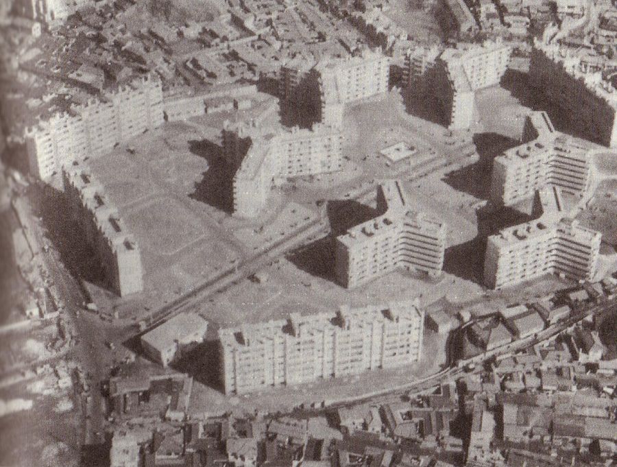
An even better photo (looking west) reveals the complex's surroundings, showing just how much they stood out in a landscape of single-storey houses:
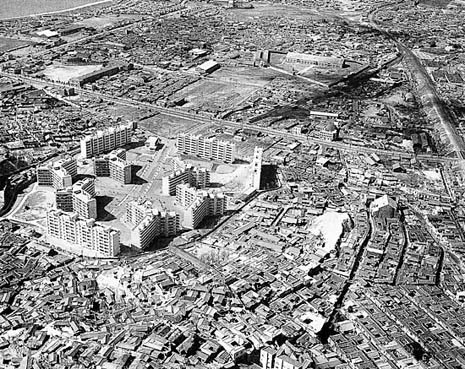
Below is a shot of the area from 1970 looking northeast, with the Mapo Apartments on the left.

[Update:] Here are some photos I received from Julia Welch, who wrote me after reading this post:
I am an American citizen who lived in the Mapo apartments with my 2 young boys in 1969 and 1970 when my then husband was serving in the US Army and stationed south at a missile base at Reno Hill. I have fond memories of my lovely neighbors. ... When you entered the complex we were in the first long building to the right on the second floor.

Of the photos, she wrote, "One is hanging on the wall by my front door - it is our view out the children's window to the maze of traditional homes." Here are some of them.

Above is the view out the front window, which I made by stitching two photos together. Below is the same view in another season:

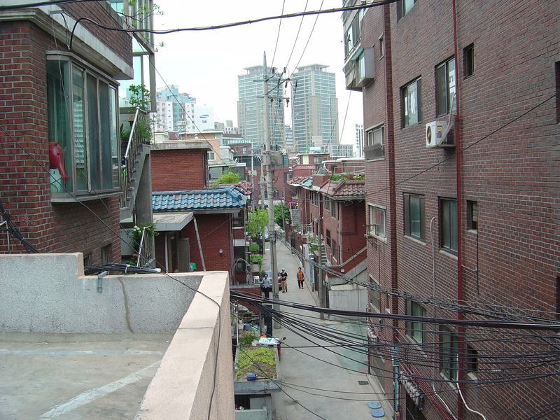
While those views might seem familiar to those who live in Seoul today, the photos taken from the other side of the apartment showcase a very different view than what we can see today:
 View from the boys' bedroom.
 Buddhist Temple
 View from the kitchen.
 View from the bathroom.
 View from the back window.
 The Mapo market, behind the apartments.
Thank you very much for the photos, Mrs. Welch! It's great to be able to see these scenes, especially in colour.
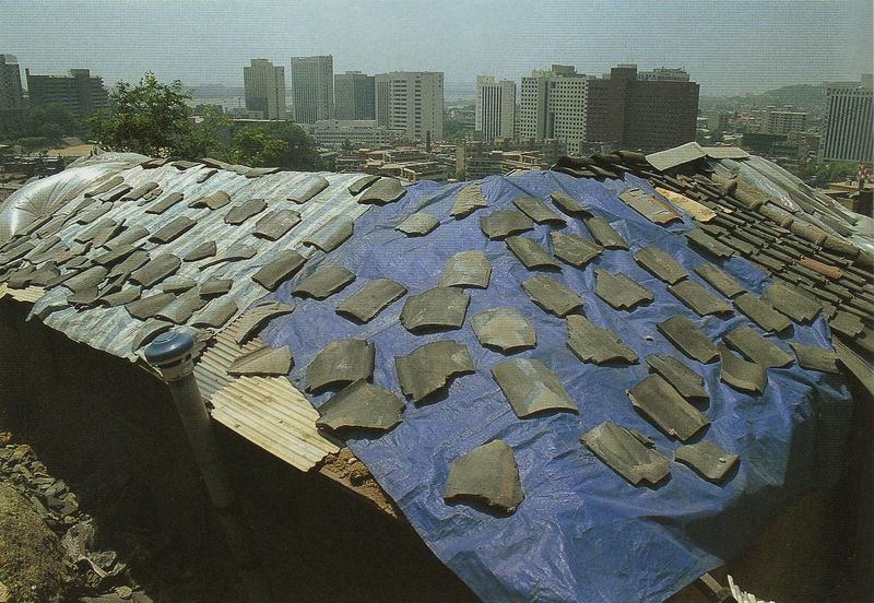
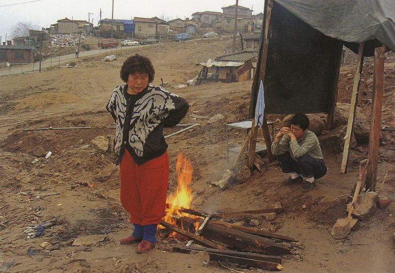
To see the fate of these single-storey houses 25 years later, you need only look at '그 골목이 품고있는 것들' ('The things embraced by the alleyways') a book of photos by Kim Ki-chan and Hwang In-suk. I began to notice, while looking at the photos taken in Dohwa-dong between 1988 and 1991, that a number of them had the Mapo apartments and Holiday Inn in the background. In these photos, you can see how much the area around Mapo-ro had changed, as the street is now lined by a number of tall buildings, including the brown-coloured Holiday Inn. Almost all of the photos in which the Mapo apartments and Holiday Inn are visible are looking west, which helps give you a sense of space and helps you, to some degree, orient yourself around this neighbourhood.

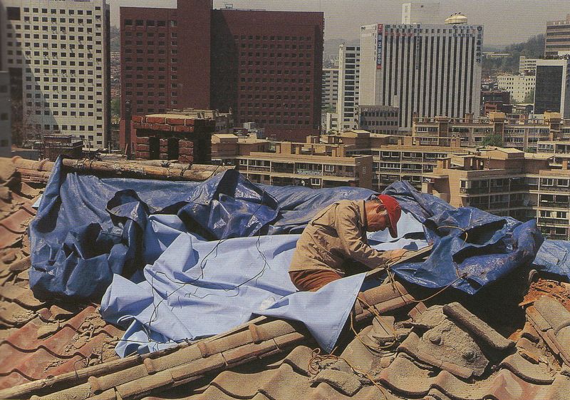
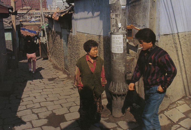

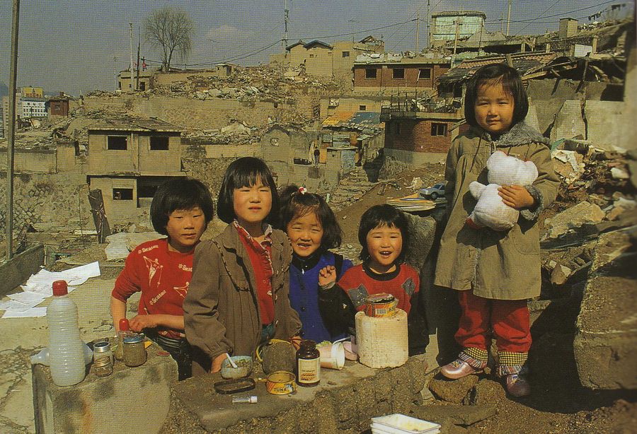
I was introduced to the photography of Kim Ki-chan by a post over at the Metropolitician. In it (about a quarter of the way down) he talks about interviewing Kim Ki-chan, and discussing with him the fact that the golmok (the small back alleys, in older, cramped, single-storey dwelling neighbourhoods of Seoul), the focus of so much of his photography, were disappearing. He had set out to document a disappearing urban environment, and the way of life that came with it; Dohwa-dong was most certainly not an exception in this regard:

When these golmok neighbourhoods were torn down in Dohwa-dong, the Mapo apartments were not spared; as Lankov notes, they were demolished in March, 1991. The satellite photo/map below reveals what has (unsurprisingly) replaced much of the neighbourhood pictured above (click to enlarge):
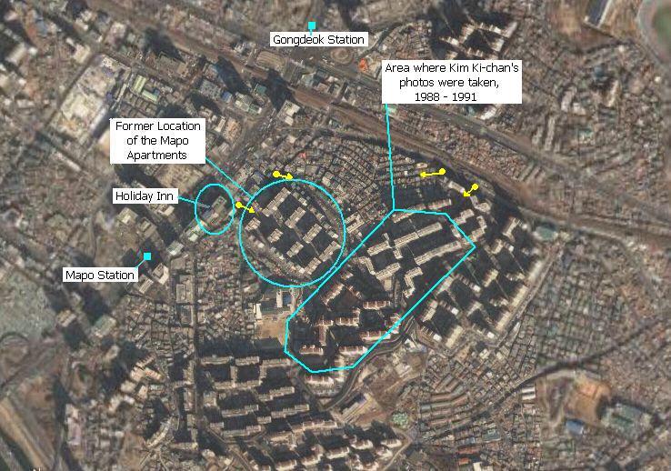
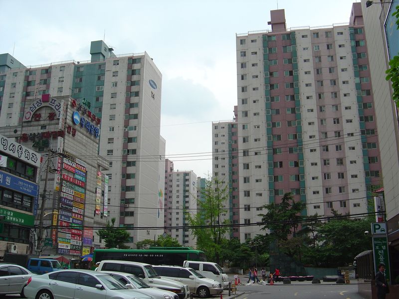
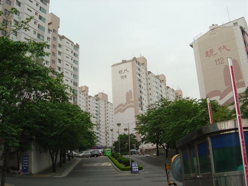
Last weekend I walked around Dohwa-dong briefly to take a few snapshots. The (crude) yellow arrows on the map above show where (and in what direction) I took the four following photos (the dots can be 'read' in order, from left to right). Looking east from behind the Holiday Inn, these are the Samsung apartments which replaced the original Mapo apartments.
Looking slightly northeast, we catch a glimpse of the Mapo Mansion Apartments, which loom over the four to five storey villas below...
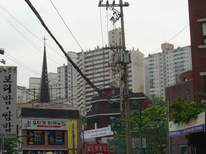
...streets lined with which are clearly visible below (looking back west, with the Samsung Apts in the distance).
At the main gate of the Mapo Mansion Apartments, looking southwest, you may notice a slight difference between the living environment on this hill now...
..and the living environment on this hill in 1989 (looking west from the top of the hill).
One wonders if the developers of the original Mapo apartments had any idea what they were unleashing on the landscape of Korea. Did they have a 5 year plan to begin zealously imposing endless monotony on the landscape, with reinforced concrete towers sprouting like mushrooms all over the penninsula, or was it ultimately just as spontaneous and random as the golmoks Kim Ki-chan used to wander through in his quest to preserve on film what the descendents of the Mapo Apartment's developers would soon pave over?
1 comment:
I am an American citizen who lived in the Mapo apartments with my 2 young boys in 1969 and 1970 when my then husband was serving in the US Army and stationed south at a missle base at Reno Hill. I have fond memories of my lovely neighbors. I am so glad to find your website and photos. I knew the apts were torn down and I thought the olympic stadiums stood there. I'm shocked to see the ritzy Mapo Mansions.
I'll look for your e-mail address and send you some photos. One is hanging on the wall by my front door - it is our view out the children's window to the maze of traditional homes.
Julia Welch
Post a Comment